Digital Twin Solution
Transform photorealistic 3D twins into a Spatial AI platform for
decision-making, prediction, and action.
Kudan PRISM is a next-generation digital twin platform that unifies facility and infrastructure data within a photorealistic 3D environment.
By bringing together site conditions, asset information, IoT sensor data, and inspection records in one spatial platform, PRISM enables smarter information management, spatial understanding, simulation, change detection, and risk prediction - empowering teams to make faster, more informed decisions on site.
From a digital twin you can see, to spatial intelligence you can act on
Field data is increasing.
Yet it remains difficult to turn it into actionable insight.
In the field, drawings, photos, and sensor data are often managed separately. As a result, searching for information, checking site conditions, and resolving gaps in understanding create a significant burden for teams.
At the same time, much of the data collected remains locked inside specialized tools, limiting its use in day-to-day operations.
Scattered Information
Data is fragmented, making it time-consuming to search for and verify the information needed.
Need for Repeated Site Visits
Repeated site visits are often required to confirm conditions and build a shared understanding among stakeholders.
Limitations of 2D Data
Limitations of 2D Data
2D data lacks sufficient information, making it difficult for stakeholders to share and use effectively.
Limited AI Utilization
Limited AI Utilization
Data remains unstructured, preventing it from being applied to anomaly detection and risk prediction.
PRISM recreates the site, understands the space, captures change,
and supports the next action.
Kudan PRISM recreates real-world sites as photorealistic 3D spaces, linking all relevant information and AI analysis results into a single, centralized environment.
By understanding spatial context, detecting changes, and predicting risks through its core algorithms, PRISM transforms site management from passive record-keeping into proactive decision support.
From point cloud–centric management to a
photorealistic 3D foundation built for AI.
| Comparison Item | Conventional Approach (Point Cloud / BIM-Centric) | Kudan PRISM |
|---|---|---|
| Spatial Visibility | Difficult to understand intuitively with point cloud–centric visualization | Photorealistic 3D that anyone can easily understand |
| Accessibility | Requires selecting a large-scale viewing environment | Lightweight and easy to view on the web |
| Data Integration | Scattered across different systems | Centralized management within a 3D space |
| AI Readiness | Complex and difficult to apply to AI | Seamless integration of spatial perception and AI |
| Change Intelligence | Relies on visual checks and comparison of separate materials | Automatically detects changes through 3D difference analysis |
| Scenario Validation | Reviewed separately using 2D drawings | Intuitive verification within a photorealistic 3D environment |
| Risk Insight | Relies on past records and experience | Analyzes risks based on data |
| Decision Support | Time-consuming due to document review and site checks | Enables faster decisions while viewing the 3D space |
3DGS × Spatial Perception
Transform 3D data from “a model for viewing” into “operational data for decision-making”.
3D Gaussian Splatting
Role
Photorealistic 3D reconstruction of the site
Value
Share site conditions in a form that anyone can understand intuitively.
Spatial Perception
Role
Understanding position, structure, and spatial relationships
Value
Capture the locations of equipment and structures, movement paths within the space, layouts, and accessibility.
Semantic Spatial Understanding
Role
Understanding the meaning of the space
Value
Recognize and contextualize equipment, hazardous areas, and other relevant elements within the 3D space.
Spatial Editing & Simulation
Role
Spatial editing and pre-validation
Value
Simulate equipment placement, flow lines, and construction procedures directly within the 3D space.
Change & Difference Analysis
Role
Detecting time-series changes and differences
Value
Compare past and current data to detect construction progress, deterioration, and anomalies.
Predictive Risk Analytics
Role
Risk prediction and prioritization
Value
Analyze signs of anomalies from multiple data sources and support maintenance prioritization.
Next-Generation Spatial and Asset Management Powered by PRISM
Build a field data foundation that AI can understand and utilize.
01. Photorealistic 3D Twin
Recreate sites as realistic 3D spaces with 3DGS.
02. Semantic Spatial Understanding
Turn 3D spaces into searchable, analyzable data.
03. Unified 3D Information Management
Link equipment, drawings, inspections, and IoT data in 3D.
04. Change & Difference Analysis
Compare past and present models to detect changes and anomalies.
05. Construction & Layout Simulation
Validate equipment placement and workflows in 3D.
06. Predictive Risk Analytics
Analyze inspection and sensor data to support risk management.
07. IoT, CAD & BIM Integration
Overlay IoT data in 3D and connect with CAD, BIM, and existing systems.
08. Flexible Deployment
Deploy flexibly across cloud, private cloud, or local environments.
From infrastructure and facilities to cities and robotics, PRISM expands how field data is used.
Bring inspection, maintenance, construction, explanation, and simulation into one 3D foundation.
PRISM goes beyond information integration, turning field data into better decisions and actions.
Asset Management
Make equipment information “searchable” and “usable” within 3D space.
Current Challenge
Information is scattered across multiple systems, making verification and sharing time-consuming.
PRISM Solution
Integrate equipment data and manuals into a 3D model. AI recognizes equipment and streamlines registration work.
Unified equipment information
Intuitive search in 3D
Automated equipment registration with AI
Time-series management of repair and inspection records
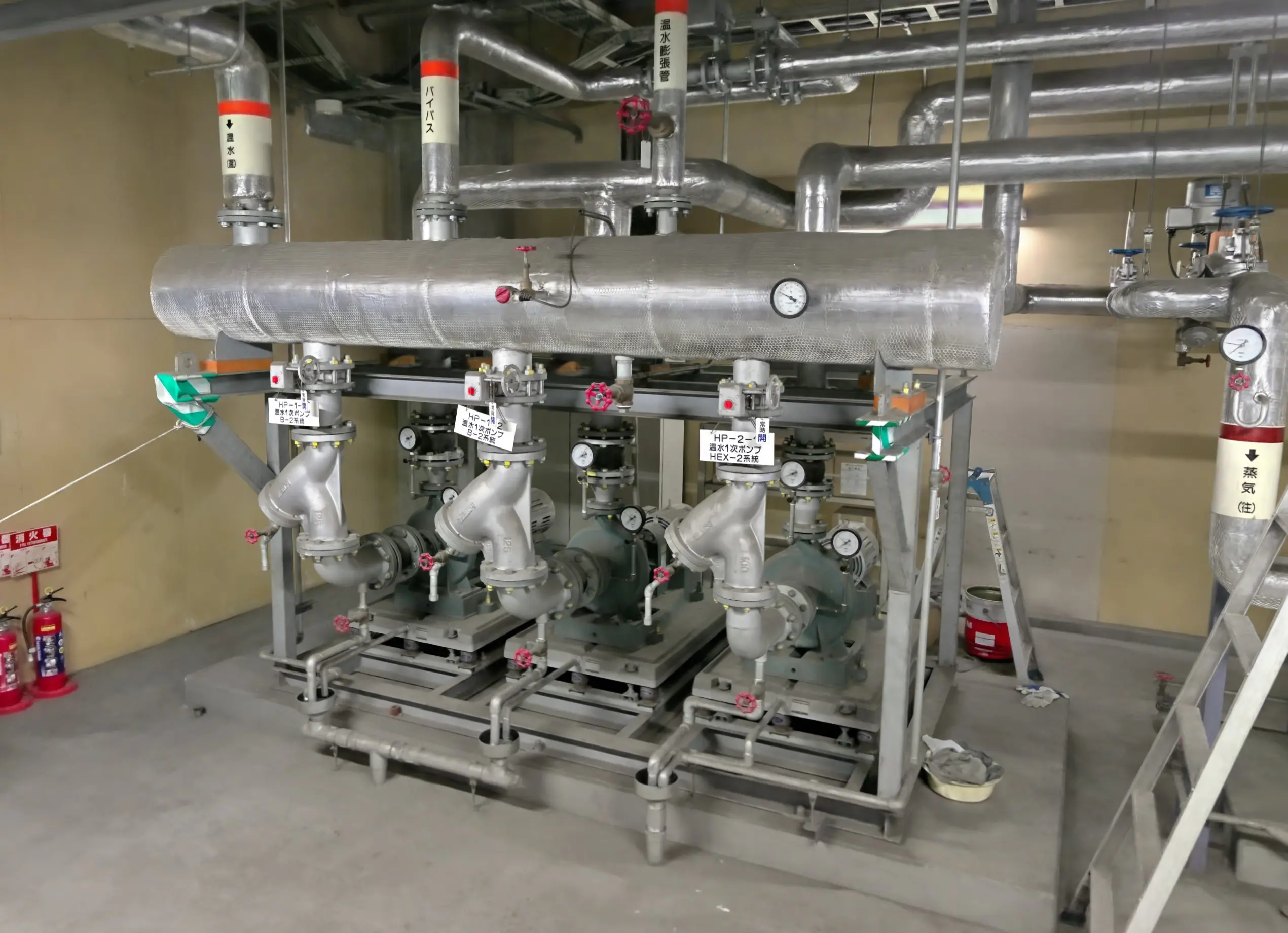
Inspection & Maintenance
From visual inspection to AI-assisted predictive maintenance.
Current Challenge
Large-scale inspections require time and cost, and often depend on visual checks.
PRISM Solution
Detect anomalies with drones and AI, compare with past data, and enable efficient preventive maintenance.
Detect cracks, rust, deformation, and deterioration
Compare with past 3D models
Visualize risk areas
Support repair priority decisions
Construction Simulation
Validate layout, flow lines, and interference in 3D before construction.
Current Challenge
Drawings alone can lead to misunderstandings and rework.
PRISM Solution
Check layout, movement paths, and interference in 3D, enabling smoother construction planning.
Simulate equipment relocation and placement
Check transport routes and work lines
Interference checks
Pre-validate work procedures
Real-Time Monitoring
Understand equipment operation and site conditions in real time within 3D space.
Current Challenge
Information is scattered, making it difficult to intuitively identify where issues occur.
PRISM Solution
Integrate monitoring cameras and sensor data into 3D space to understand site conditions in real time.
Display sensor data in 3D
Intuitively identify anomaly locations
Visualize equipment operating status
Unified management of alerts and responses
Stakeholder Alignment
Build consensus faster and more accurately by sharing the same 3D space.
Current Challenge
Drawings and technical documents alone are hard to understand, slowing consensus-building.
PRISM Solution
Visualize the planned outcome in photorealistic 3D and accelerate stakeholder alignment.
Improve explanation quality
Reduce recognition gaps
Speed up consensus-building
Create shared understanding among stakeholders
Robotics Simulation
Turn real sites into virtual testbeds for robot development.
Current Challenge
Real-world robot testing requires significant time and resources.
PRISM Solution
Recreate real sites as 3D models and enable safe navigation testing in a virtual environment.
Simulate real-world sites
Pre-validate navigation routes
Check obstacle avoidance and work lines
Reduce risks before on-site deployment
Reduce the time required for site checks, information search, inspections, and stakeholder communication.
Turn field data from something you can see into something you can use.
Reduced Site Visits
Check site conditions using the latest 3D spatial data, without going on site.
Cost Reduction
Reduce operational costs by cutting the time spent on information search and site visits.
Productivity
Streamline everything from equipment management to decision-making within a single 3D space.
Enhanced Reliability
Detect deterioration and anomalies early to improve maintenance decisions.
Predictive Maintenance
Identify signs of anomalies from various data sources and support preventive maintenance.
Knowledge Transfer
Record expert knowledge within 3D space and support technical knowledge transfer.
Flexible deployment
from cloud to edge.
Kudan PRISM supports cloud environments for organization-wide use, as well as edge and on-premise deployments for on-site operations, closed networks, and advanced security requirements.
PRISM Cloud
Cloud-based deployment for multiple sites and company-wide use.
Easily accessible from a web browser.
Private Cloud
Operated within the customer’s own environment, supporting high security requirements and internal policies.
PRISM Local
Designed for closed networks and strict data management environments.
Can be operated locally as a Windows application.
Transform field data into decision-ready 3D assets.
Powered by spatial AI, Kudan PRISM understands the site, predicts risks, and helps teams take the right next action.
Move from 3D data trials to real-world operations.
PRISM connects field data with decision-making, creating a new foundation for smarter operations.